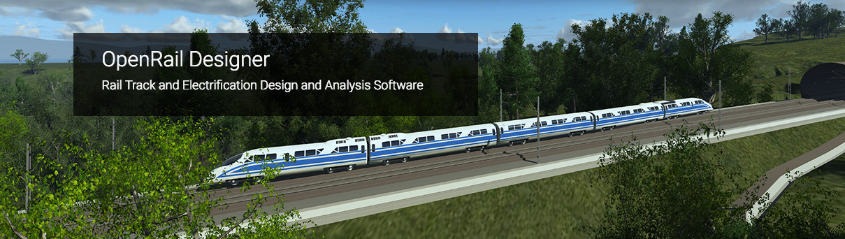
OpenRail Designer OpenRail Designer introduces a new, comprehensive modeling environment for streamlined project delivery of rail network assets. This environment unifies design and construction from concept through commissioning and completion. The application delivers a high performance, immersive, 3D modeling environment that enables instantaneous and interactive parametric modeling of rail corridors. OpenRail Designer provides modeling and design capabilities for metro, light rail, commuter rail, or high-speed rail design projects. You can save time on the design and maintenance of track, station, and yard design, as well as overhead line electrification (OLE), while significantly increasing productivity. • Bring real-world settings to your project by gathering context data quickly from a variety of sources, such as point clouds, 3D reality meshes, terrain data, images, and geospatial information. • Enable project information sharing across teams, locations, and disciplines with precision and security. • Perform regression analysis, horizontal and vertical alignment, cant design, and turnout placement to international standards. • Design OLE systems with customizable design standards and 3D modeling of wires and structures. • Improve asset quality and reduce rework with a fully localized application. • Share realistic visualizations with the public and stakeholders to gather feedback, improve public engagements, and speed project approvals. CAPABILITIES • Analyze rail and sleeper placement o Rail placement capabilities ensure calculation of precise rail coordinates and joints with track widening tables and cant data. You can also create simple and long sleepers based on your geometry and turnout locations. • Analyze rail track regressions o Convert surveys of track data into full alignments using regression analysis. Determine the best fit geometry alignment of your track from a range of survey data types, including transition types and cant. You can then use this geometry to produce design changes. • Automate rail drawing production o Utilize the Documentation Center for automated production of high-quality drawings, including multi-discipline documentation sets that are consistent across the entire project. Get a live view of the project in sheet orientation. As the design changes, so will the sheets. Make edits directly in the sheets and OpenRail Designer will update the source geometry. • Create profiles and cross sections o Create profiles and cross sections from any point within the design. View updates on the fly as the design is modified with dynamic cross sections. You can see the ground changing to reflect design edits. Include surface features, corridor components, and notations such as construction limits or stationing. • Design and analyze rail and road corridors o Use immersive corridor modeling capabilities that support complex modeling and file federation demands required by BIM Level 2 and beyond. Streamline the complex development of every aspect of the railway in a single, parametric presentation. You can move rapidly along a corridor at controlled intervals, viewing and dynamically designing all railway components in concert. • Design and place rail signals o Configure and place signals within a rail model. Build signals interactively from items such as hoods, aspects, and masts. Then use linear referencing to place and orient your signals relative to the track. Geographic and schematic views of the same signal scheme can be produced if required. • Design in context o Clearly understand existing conditions and accelerate design modeling workflows with the ability to easily integrate imagery, point clouds, and 3D reality meshes into design and construction models. Integrate geospatial information to ensure that models are precisely geospatially located. • Design rail track drainage systems o Ensuring appropriate drainage is included within rail designs is vital to ensuring the availability of the railway. Preventing storm or floodwater from damaging your rail network through effective design will reduce maintenance costs and increase availability of the network. • Design track geometry

This is your website preview.
Currently it only shows your basic business info. Start adding relevant business details such as description, images and products or services to gain your customers attention by using Boost 360 android app / iOS App / web portal.
2019-07-03T05:12:12
OpenRail Designer OpenRail Designer introduces a new, comprehensive modeling environment for streamlined project delivery of rail network assets. This environment unifies design and construction from concept through commissioning and completion. The application delivers a high performance, immersive, 3D modeling environment that enables instantaneous and interactive parametric modeling of rail corridors. OpenRail Designer provides modeling and design capabilities for metro, light rail, commuter rail, or high-speed rail design projects. You can save time on the design and maintenance of track, station, and yard design, as well as overhead line electrification (OLE), while significantly increasing productivity. • Bring real-world settings to your project by gathering context data quickly from a variety of sources, such as point clouds, 3D reality meshes, terrain data, images, and geospatial information. • Enable project information sharing across teams, locations, and disciplines with precision and security. • Perform regression analysis, horizontal and vertical alignment, cant design, and turnout placement to international standards. • Design OLE systems with customizable design standards and 3D modeling of wires and structures. • Improve asset quality and reduce rework with a fully localized application. • Share realistic visualizations with the public and stakeholders to gather feedback, improve public engagements, and speed project approvals. CAPABILITIES • Analyze rail and sleeper placement o Rail placement capabilities ensure calculation of precise rail coordinates and joints with track widening tables and cant data. You can also create simple and long sleepers based on your geometry and turnout locations. • Analyze rail track regressions o Convert surveys of track data into full alignments using regression analysis. Determine the best fit geometry alignment of your track from a range of survey data types, including transition types and cant. You can then use this geometry to produce design changes. • Automate rail drawing production o Utilize the Documentation Center for automated production of high-quality drawings, including multi-discipline documentation sets that are consistent across the entire project. Get a live view of the project in sheet orientation. As the design changes, so will the sheets. Make edits directly in the sheets and OpenRail Designer will update the source geometry. • Create profiles and cross sections o Create profiles and cross sections from any point within the design. View updates on the fly as the design is modified with dynamic cross sections. You can see the ground changing to reflect design edits. Include surface features, corridor components, and notations such as construction limits or stationing. • Design and analyze rail and road corridors o Use immersive corridor modeling capabilities that support complex modeling and file federation demands required by BIM Level 2 and beyond. Streamline the complex development of every aspect of the railway in a single, parametric presentation. You can move rapidly along a corridor at controlled intervals, viewing and dynamically designing all railway components in concert. • Design and place rail signals o Configure and place signals within a rail model. Build signals interactively from items such as hoods, aspects, and masts. Then use linear referencing to place and orient your signals relative to the track. Geographic and schematic views of the same signal scheme can be produced if required. • Design in context o Clearly understand existing conditions and accelerate design modeling workflows with the ability to easily integrate imagery, point clouds, and 3D reality meshes into design and construction models. Integrate geospatial information to ensure that models are precisely geospatially located. • Design rail track drainage systems o Ensuring appropriate drainage is included within rail designs is vital to ensuring the availability of the railway. Preventing storm or floodwater from damaging your rail network through effective design will reduce maintenance costs and increase availability of the network. • Design track geometry
2019-07-03T05:12:12
Share it on


Keywords
- design changes
- design modeling
- effective design
- rail track drainage
- design capabilities
- rail network assets
- rail design projects
- reflect design edits
- 3D modeling environment
- environment unifies design
- customizable design standards
- interactive parametric modeling
- Integrate geospatial information
- comprehensive modeling environment
- immersive corridor modeling capabilities
Submit Your Enquiry